Milingimbi Shop Upgrades

Client: ALPA
Location: Milingimbi Island, Northern Territory
Services: 3D Laser Scanning, Visualisation

PROJECT BACKGROUND

The Arnhem Land Progress Aboriginal Corporation (ALPA) is Australia’s largest Independent Aboriginal Corporation. They lead the way in Remote Retailing, Community Service Program Delivery, Enterprise, Economic Development and Corporate Services.

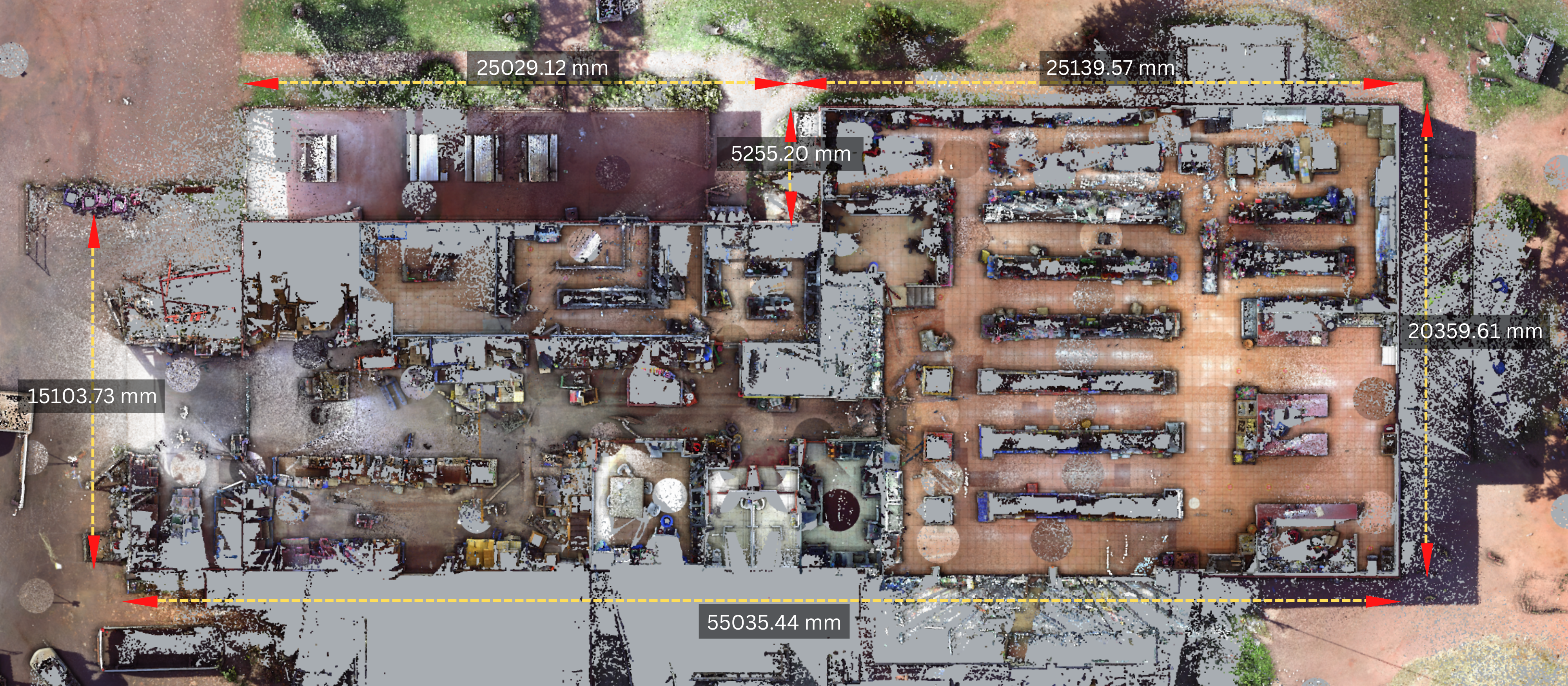
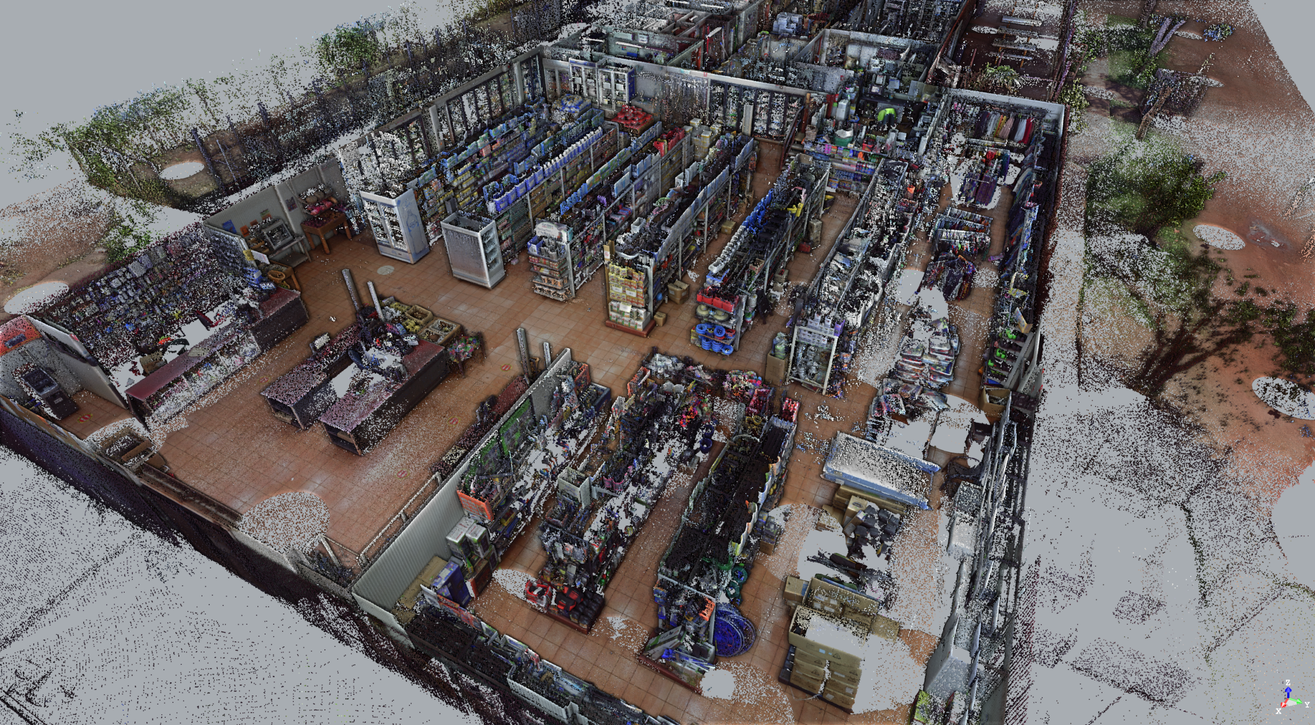
Holovision NT was engaged by ALPA to trial our 3D Laser Scanning & Visualisation solutions to assess how it would improve upon their previous facilities management practices for their 27 stores located in remote communities across the Northern Territory.

The challenges of these practices were mostly due to the remoteness of the sites, travel logistics and thus traditional contractors’ inability to adequately and efficiently measure the sites, requiring repetitive and costly site visits.

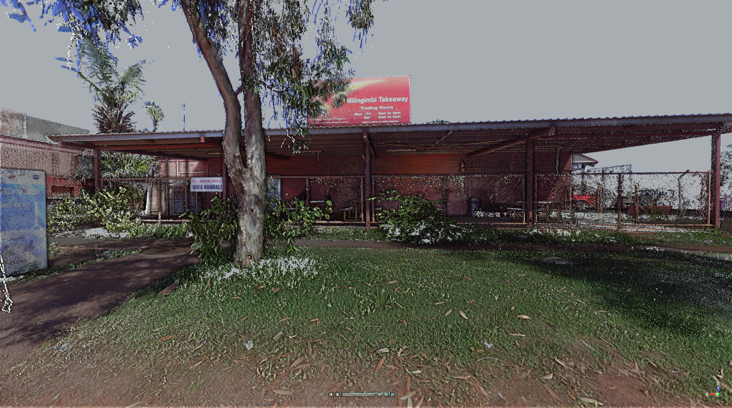
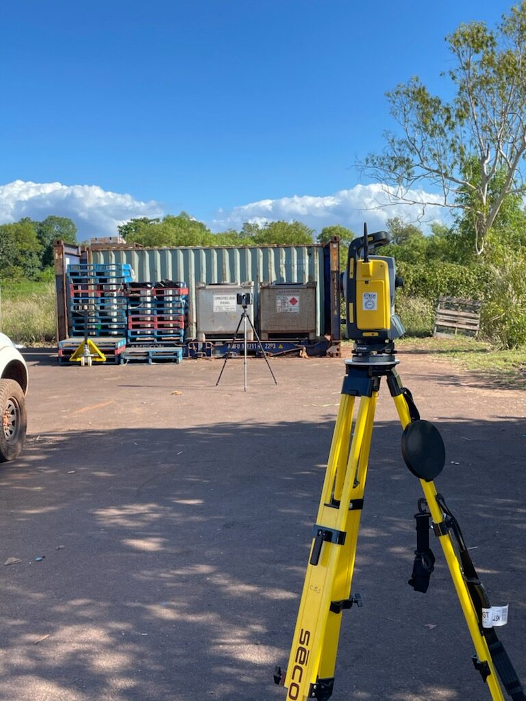
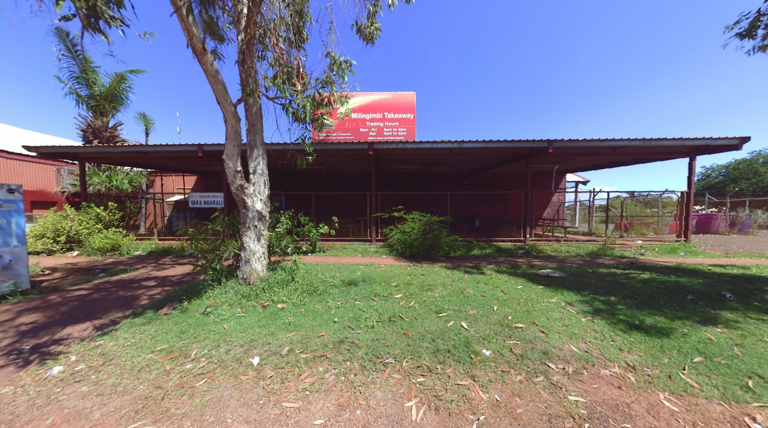
ALPA was proposing improvements to its Milingimbi Community Store to better service the needs of the community, so the Holovision NT Spatial Team performed laser scanning of the full facility.

BENEFITS TO CLIENT

  • Having the point cloud data accessible remotely (web-based viewer), eliminating the usual costs of flying in other project parties for physical site visits.
  • This data remains a base model for future developments of the site, eliminating the need for repetitive and expensive contractor visits.
  • Laser Scanning enabled efficient and comprehensive measurements when time on site was limited, saving costs and coordination for the client
THE CHALLENGE
 
  • To engage a consultant or builder to visit remote sites to plan for works, ALPA would often have to coordinate them with prescheduled single-day round trips, meaning contractors would have limited time on site each visit.
  • The limited time on site does not allow for comprehensive site measurement using traditional methods. This would result in multiple site visits. Also, contractors often have a clause stating they require additional site visits to confirm measurements, adding further costs, planning time and travel coordination.
  • Up-to-date plans rarely exist for remote sites such as these, meaning consultants often start from scratch to create new site plans, adding to planning times and costs.

OUR SOLUTIONS

  • 3D laser scanning allows comprehensive and accurate site information to be collected and stored in one visit.
  • Laser scanners collect data about existing structures in a fraction of the time of traditional methods, and the millions of points in space captured ensure all the measurement data required has been scanned.
  • The scan data can be used for future maintenance and development. Shop info can be quickly accessed by viewing the scan data using an online platform, and they don’t physically need to visit site to begin planning. The data can be shared to all relevant parties to be viewed at any time, from anywhere. This measurably improves design processes and collaboration.